
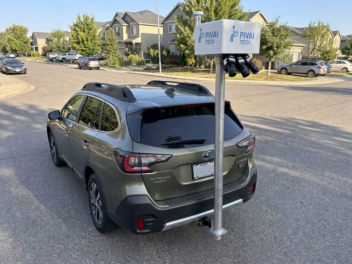
Simple hardware. Serious data.
One camera enclosure on a vehicle you already own, not a six-figure LiDAR van. Choose real-time detection, survey-grade precision, or both.
Inspect every road, every time you drive it.
Argus mounts on the roof of any vehicle in minutes and runs PIVAI's AI on the device. Crews drive their normal routes while Argus builds a GPS-tagged inventory of defects and assets, with video back-up for every detection.
Signs & assets
Traffic signs, signals, poles, lighting, hydrants, cameras and overhead cables, inventoried with location and condition.
Potholes & cracks
Longitudinal, transverse and alligator cracking and potholes, with severity, not just a yes or no.
Real time
30 FPS on-device inference. Results appear on the map while the vehicle is still moving.
Any vehicle
Suction or rack mount, one cable. Safer than walking surveys and no dedicated survey fleet.
- Sensors1080p RGB camera with depth, GNSS and IMU in one weather-sealed enclosure
- ProcessingEdge AI on the unit, at 30 frames per second
- DetectsCracks, potholes, signs, traffic lights, poles and lighting, lane markings, hydrants, overhead cables
- AccuracyGreater than 90% detection accuracy in field trials
- OutputLive map, geotagged detections with video frames, asset inventory, GIS export
Survey-grade pavement data without closing a lane.
Atlas mounts on a standard trailer hitch. Three industrial cameras and a GNSS/INS record the full lane at 2 mm per pixel while you drive with traffic. Our photogrammetry and AI turn it into a seamless 2 mm image of the road, a 3-D surface model and a crack-by-crack condition survey.
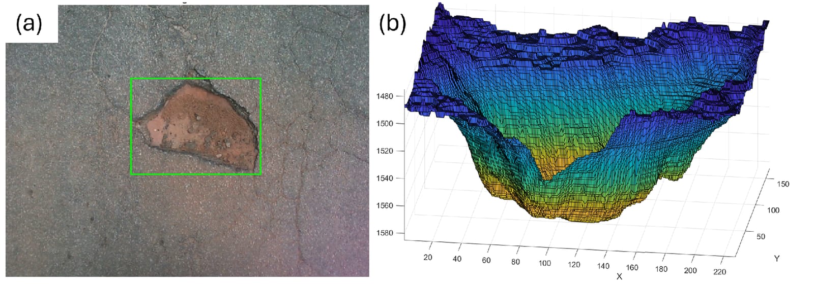
Dimensions, depth and severity, not a colour score.
Every crack is measured from the 2 mm image and classified as isolated, block or alligator cracking following the distress definitions in ASTM D6433. Potholes get area and depth from the 3-D model, so maintenance quantities come straight from the data.
- Cameras3 × industrial machine-vision cameras, rear-facing, overlapping across the full lane
- PositioningSurvey-grade GNSS/INS, time-synchronised with every frame
- MountingStandard trailer hitch on an everyday vehicle
- AnalysisCrack detection, measurement and classification; crack condition index (PCI proxy) per sample unit
- DeliverablesPDF report and map book, GeoTIFF imagery and elevation model, GeoJSON, CSV, Google Earth KMZ
Buy the unit, or let us survey for you.
Every network is different. Tell us your roads and goals and we'll put together a proposal.
Buy & operate
You own the Argus or Atlas hardware and run your own surveys; we power the intelligence. Includes the PIVAI platform software, updates and support, with data and analytics on top.
- HardwarePIVAI Argus and/or PIVAI Atlas units
- SoftwareAnnual platform subscription per unit
- Best forAgencies and consultants surveying often
Survey-as-a-service
We operate the equipment and deliver the data. You receive a condition report, GIS maps and every deliverable, priced per lane-mile.
- Argus surveyNetwork-wide AI inspection
- Atlas survey2 mm precision pavement survey
- You receivePCI-style report, map book and GIS data
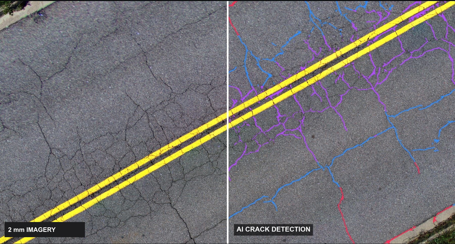
See what PIVAI finds on your roads.
Book a demo on your own network, or ask about pricing for units and survey services. We usually reply within one business day.